After enduring too much cold weather, we finally set off in our T-van (extreme off-road camper nicknamed Rex) on July 9. We were meeting friends in their van in Renmark on July 12. We were a little apprehensive being our first extended trip away in this van and it has none of the luxuries of our Traveller, but we are hooked on outback travel; not only is the outback the heart of Australia, but it is the soul from our viewpoint.
We spent the first two nights out at Barham in a lovely riverside Caravan Park. We were perched right on the bank so enjoyed the tranquillity of the setting, while avoiding the still cold weather.

On the Murray at Barham
The day we left it commenced raining while we were packing up….great with a drop-down canvas tent attached to the main van body! It rained, then poured and did not let up, so we finally rang friends in Mildura and asked if we could bunk inside for the night. It was great catching up with them…..and sleeping in a protected bed after a hot shower, lovely roast dinner, some good wine and great chatter. It had cleared by the morning but was still cold, so we headed for Renmark to meet our friends Val and David. We stayed at a lovely CP right on the Murray River in the shadows of the old lift span bridge.

Renmark lift span bridge
The plan was to travel with them for a week or so. We had two more bitterly cold days in Renmark, so spent most of the time in their air conditioned van chatting and recalling past trips. We had 2 farmstays planned next, but it was so cold, we kept driving north through Hawker to Copley (Flinders Ranges) where we booked in for 2 nights. We have both stayed at Copley several times…..bit of a soul place for both of us. But the cold persisted, as did periodic showers, so we parted company; they were going up the Birdsville Track, and we the Oodnadatta Track, both starting at Marree.

Let’s do it!!!!!!!!!!!!!!
We were filled with nervous excitement as we let the tyre pressures down, and set off on an adventure into the unknown (for us). Marree to Marla, on the Stuart Highway is 617km. It basically follows the Old Ghan Rail Route to Oodnadatta before veering off to Marla for the last 211km. From the road, you could be forgiven for thinking you are journeying over waterless plains of gibber rock and sparse vegetation. But beneath lies one of the world’s largest aquifers, the Great Artesian Basin, so all the way along the track the water squeezes to the surface creating mainly mound springs (very small to quite large mounds with permanent water supply) attracting birds, wildlife, farming, and tourists.
So we spent our days exploring the ruins of pioneering grazing, the old telegraph line, the railway sidings, and the unusual mound springs. This was also the path of ancient aboriginal trade routes deep into central Australia and back. The string of springs made it possible for McDouall Stuart to complete the first crossing of the interior in 1862. So the overland telegraph and the Great Northern Railway were constructed opening up vast pastoral leases with Sidney Kidman foremost. His Anna Creek Station near Oodnadatta, some 24,000 sq. kms still runs, and is the largest cattle station in the world!
We passed the shores of Lake Eyre South, called in at the fascinating “Bubbler”, and stayed at Coward Springs the first night.

Desolate country surrounding the mound spring ( the Bubbler)

The Bubbler mound spring
Then past Beresford bore and the ruins of the rail siding, telegraph repeater, and water purifier before venturing in to the fascinating Strangaway Springs where a myriad of mound springs existed and several remain trickling.

Permanent mound spring at Strangaways

Small “waterfall” from a mound spring at Strangaways

Water tower and purifier at Beresford Siding on Old Ghan Line
We set up camp at William Creek CP early, allowing us to take the rough track out to Halligan Bay (on the 969,000 hectare Lake Eyre). It is the lowest point in Australia at 15.2m below sea level, but still provides a vantage point for viewing Lake Eyre North. There’s not much other than a fantastic old pub and a roadhouse, both with appropriate outback character.

William Creek Pub

View of Lake Eyre North at Halligan Bay
We continued along the Track towards Oodnadatta, taking the heavily pot-holed single lane 20km side track to explore Old Peake, one of the largest and best preserved pastoral homestead ruins. An overland telegraph repeater station and copper mine were both once located at Peake, but like so many it was abandoned because of prolonged drought in the 1860’s. We spent several hours here as it was so well signposted and presented. Hard to believe this hot, dry, rocky, unforgiving country could have been farmed.

Main Homestead ruins at Peake

Slag pile at the Copper Mine, Peake Station……homestead ruins in the background
We arrived at Oodnadatta mid-afternoon and set up at the CP behind the famous Pink Roadhouse. The town began life as the terminus of the Great Northern Railway in 1889, hence the starting point for travellers heading to the Northern Territory, and a major railhead for cattle from the north. Denni wanted to do some washing, and the walk around town took no time at all……this time not even a pub, just a roadhouse! We did have a superb “Oodna burger with the lot” and chips for tea.

The sign says it all

That’s all in Oodnadatta!!!!!
We then left the Track and headed 50km down a deserted track towards Coober Pedy, then turned off to Arkaringa Station a further 40km on one of the roughest tracks so far. The attraction was the Painted Desert. No picture could do this area justice….but of the many we took I have posted one.

Part of the Painted Desert Range

Camping at Arckaringa Homestead……Painted Desert
I had noticed Dalhousie Springs was only 200km (approx.) north of Oodnadatta, and had always wanted to see it, so we headed the 100km back there early the following morning, and then off the Track north. The trip was slow as the track was narrow and heavily corrugated….what the heck! We arrived around lunchtime and set up our bush camp. The Dalhousie Spring Group has 8 active groups representing some of the largest and finest examples of Artesian Springs in Australia. The Group accounts for around 40% of the water discharged naturally from the Great Artesian Basin. The campground is at the largest of these springs. It is around 50m long and 10m deep at the deepest point…..and it is 37c day and night. That’s all good, but better still is that Dalhousie Springs is at one end of the Simpson Desert crossing, and the vibe here is electric, because everyone, except us, is just about to cross the Simpson Desert, or has just completed the iconic crossing. The buzz is to enjoy, and the talk is all about the “Simpson”, a rite of passage in the 4WD community.

The largest Spring at Dalhousie….37c

Camp line-up at Dalhousie Springs

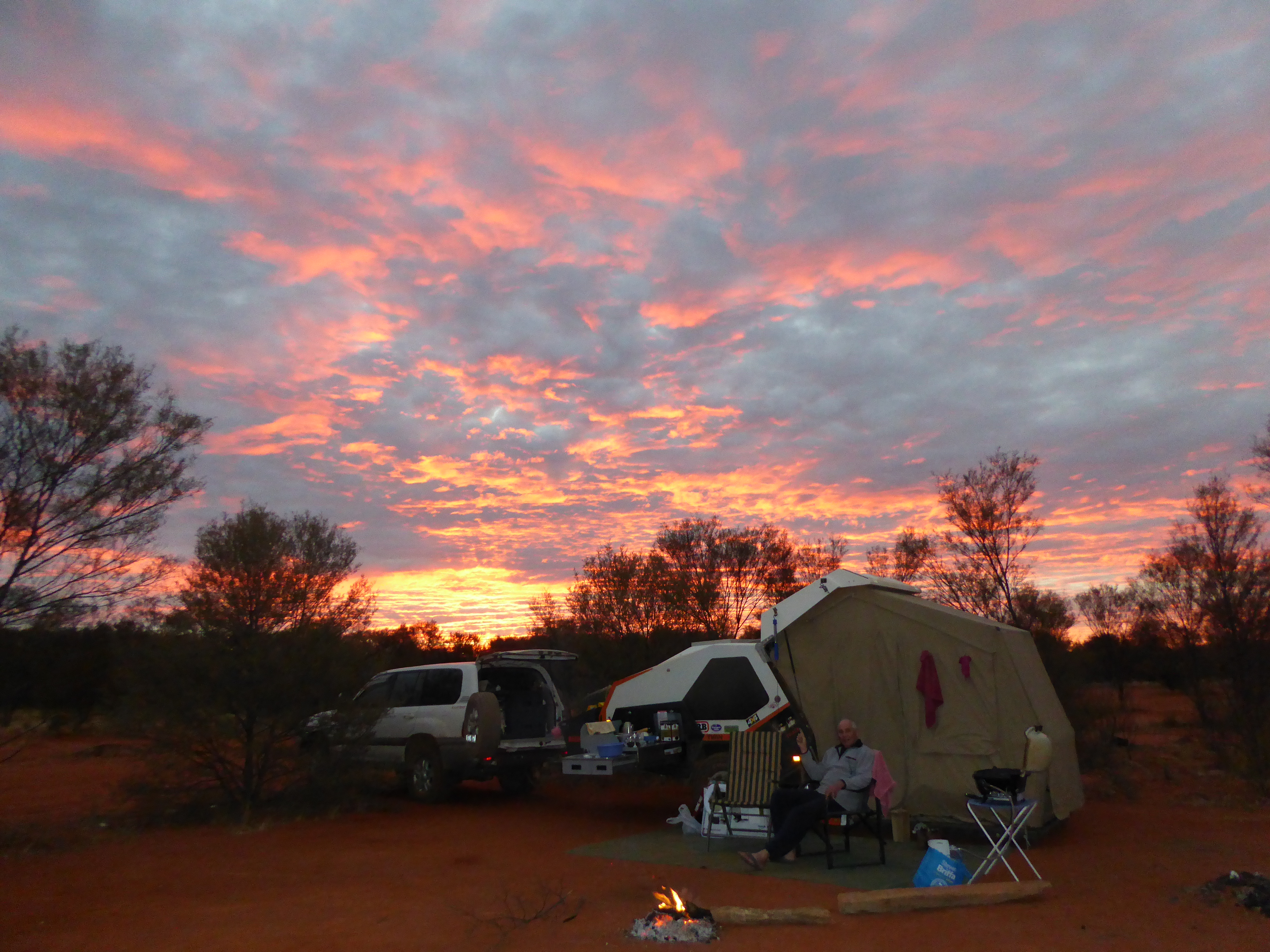
Sunset over our camp at Dalhousie Springs
We only stayed the night, and headed back to civilisation via Mt. Dare, Finke, and a bush camp for the night at “Lambert’s Centre”, the geographical centre of Australia. We had a campfire and sumptuous meal amongst the desert sheoaks…..what a place.

Lambert’s Centre…..geographical centre of Australia
Sunset at our bush camp at Lamberts Centre
We followed the track through Finke and out to the Stuart Hwy at Kulgera to return…..sort of ….to civilisation. We continued north then west to Yulara for a 4 night stop to explore Uluru and the Olgas again. The CP has its own lookout over Ayres Rock and the Olga’s in the distance, so we loved being back to finally see a sunset and sunrise over the “Rock”. We also walked around Uluru, and explored much more of the Olgas than we had time for previously.

A natural cave used by aboriginal women as a kitchen in past times

Distant shot of a small part of Uluru on the base walk

Permanent waterhole at the base of Uluru….in permanent shade

On a walking trail “inside” the Olga’s

Uluru at sunset…..finally some colour!

Yulara CP from the lookout at sunrise

The Olgas in the distance at sunrise
Pausing here, stay tuned for the ride to Broome and beyond.

Barry
This is your best post yet, loved both the photos and the commentary, makes me inspired
LikeLike
Thanks Bruce…………….it’s easy when you love what you are seeing and doing
LikeLike
Fascinating stuff Barry – what an incredible and diverse country we have … sent me searching for my old photos of 1975.
Looking forward to the next episode.
LikeLike
WOW Barry,what a fantastic experience you guys have just been through,I loved the photos of the homestead at Peake and especially the one of you sitting around the camp fire with that beautiful sunset in the distance.Also looking forward to Volume 2 of the series.
Best wishes
Ron
LikeLiked by 1 person